NAVER TwinXR is an integrated platform for various spatial intelligence technologies. There are many things that can be done with this platform. This session discusses Naver Map, a tool for the public to explore spaces.
Street View with 3D Information
The NAVER TwinXR platform adds 3D information and vivid experiences to NAVER Map. One of the most well-known services is the recently updated Street View 3D feature on NAVER Map.
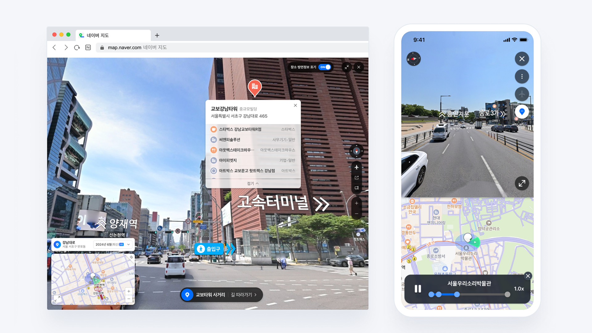
▲ The Street View 3D feature in the NAVER Map
Street View 3D is a service that allows the user to view roads and surrounding environments in 360-degree images. Previously, it simply connected flat images, which meant that spatial information such as buildings and directions had to be manually input for each image, and updating this information was very difficult.
Now, however, Street View 3D is undergoing significant changes through TwinXR Platform. The new Street View 3D can automatically apply various spatial information based on 3D coordinate values and present that information intuitively. As a result, the service has improved the efficiency of navigation, including information about the parking lots and entrances of buildings as well as the locations of shops within buildings that were previously hard to find. This all comes alongside the main course: providing the experience of seamlessly moving through a 3D space.
▲ Previous Street View VS Street View 3D
Created From Start to Finish with In-House Technology
So how is Street View 3D service produced?
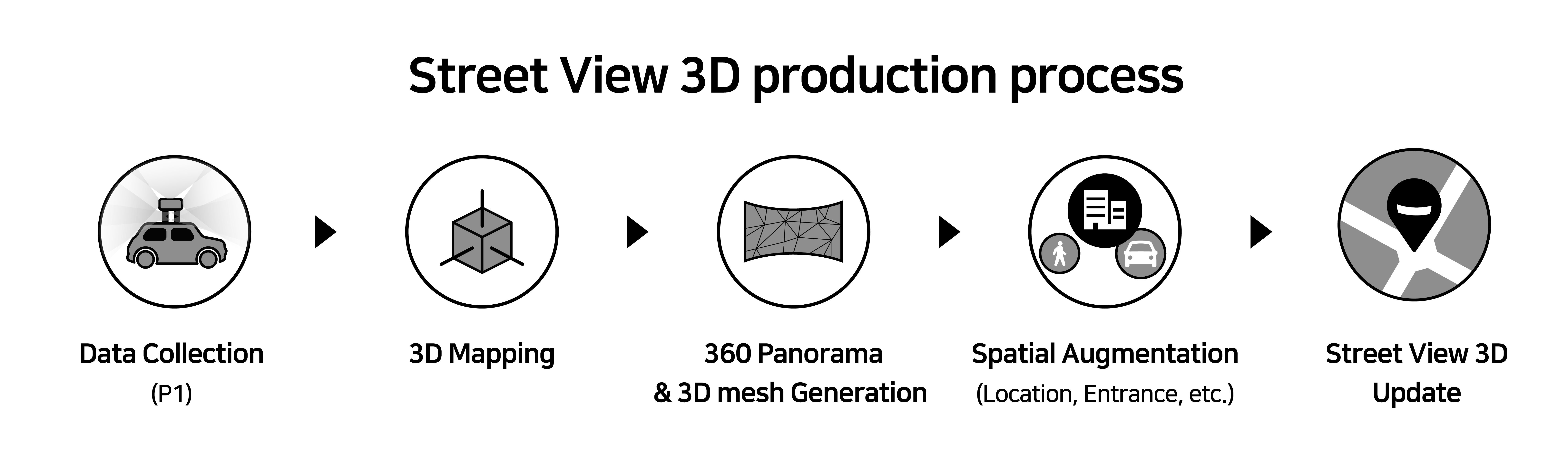
1. Data Collection
3D information on a real-world space is collected using the Panoramic Mapping System, P1. Data is collected quickly and in large quantities from various sensors, such as LiDAR and other high-performance navigation sensors before going through error-free synchronization.

▲ Panoramic Mapping System P1
2. 3D Space Reconstruction
The collected data is reconstructed into a 3D world. Precise point clouds, including 6 DoF (Six Degrees of Freedom) poses, are used to accurately represent roads and buildings.
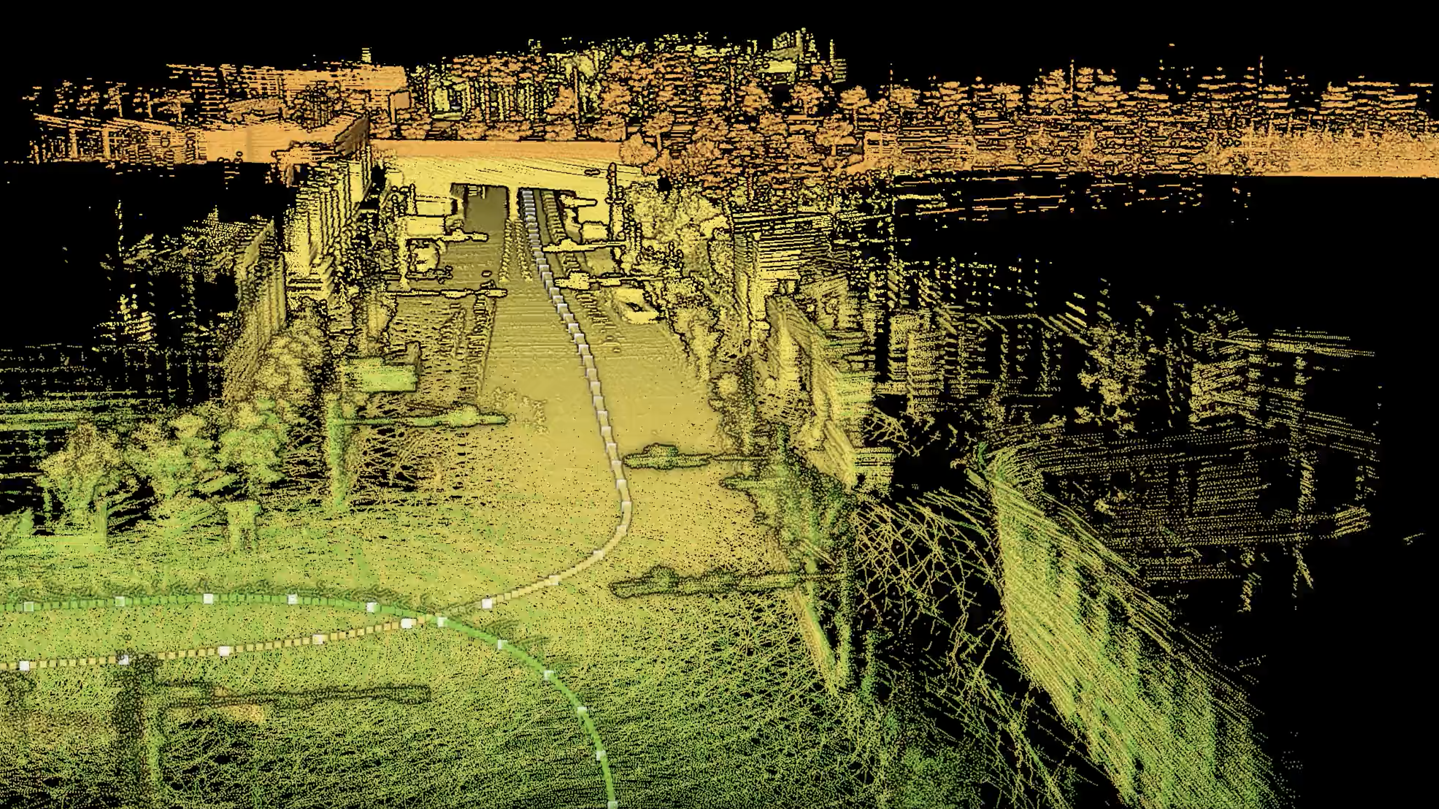
▲ Point Cloud
3. 360 Panorama & 3D Mesh Generation
High-resolution 360 panoramas and mesh data containing depth information are generated to create an environment that uses augmented 3D spatial information to enable smooth, seamless navigation through the space.
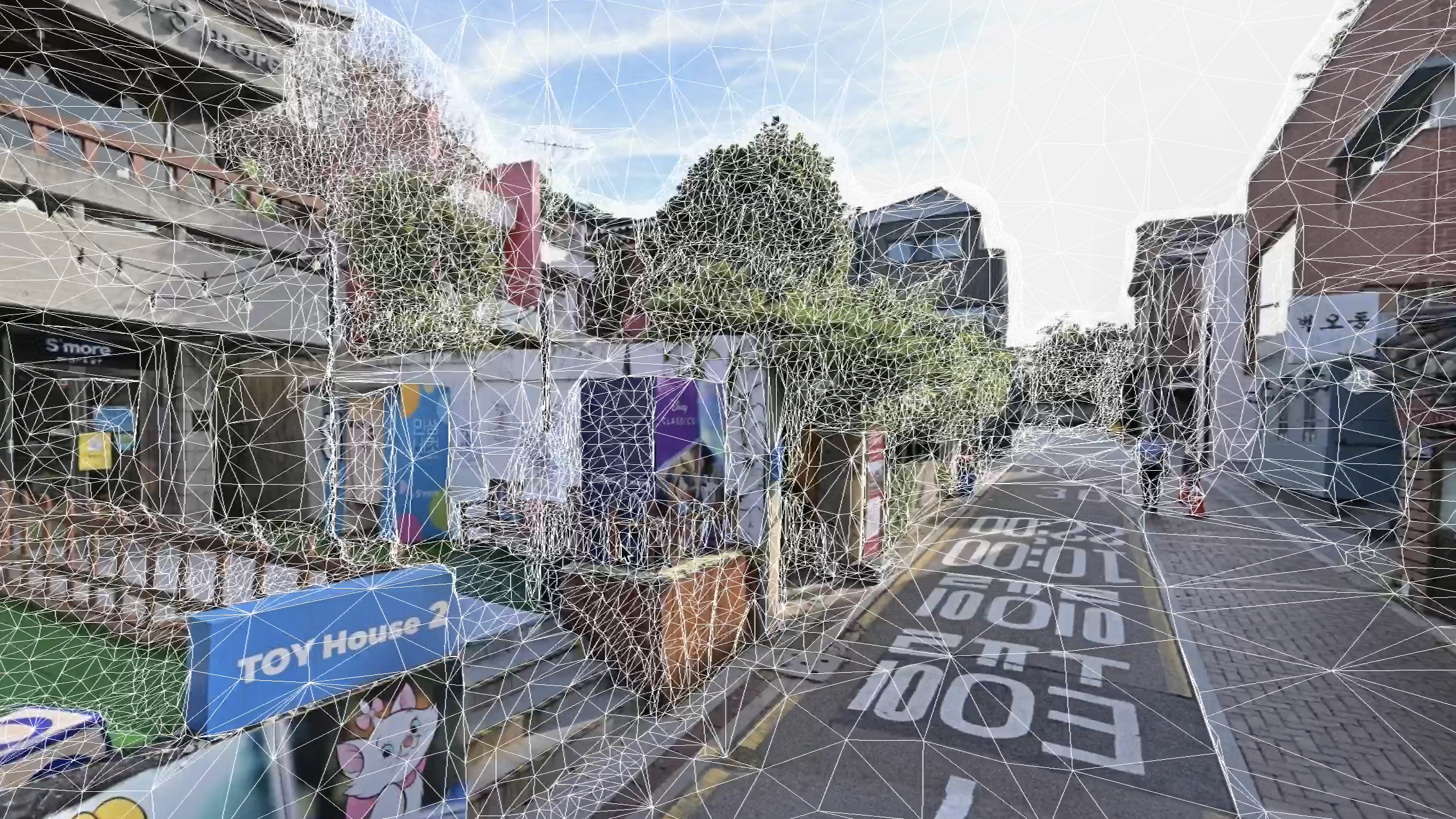
▲ 3D Mesh with Depth Information
4. A Wide Variety of Augmented Information
Information such as locations, entrances, and parking lots is accurately augmented onto buildings and roads, allowing users to intuitively access the information they need. By utilizing the space itself as an interface, new forms of information, such as digital outdoor advertising, can be infinitely added, and updates with the latest information can be rolled out with ease.
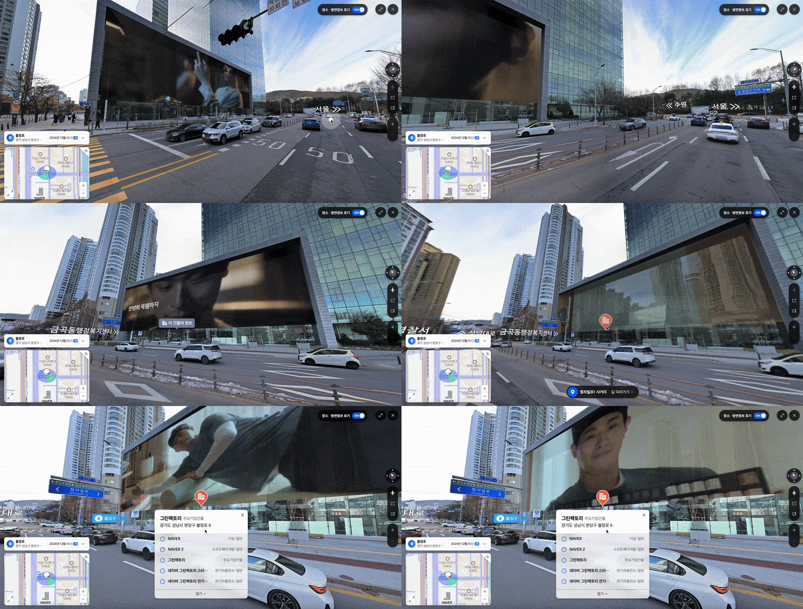
▲ Digital Outdoor Advertising and Place/Directional Information on NAVER Street View 3D
Digital Outdoor Advertising and Place/Directional Information Applied to Naver App's Street View 3D service.
The newly released Street View 3D provides spatial and movement information with remarkable realism while also being able to effectively present both information that was previously visible in the real world and information that was hidden. This aligns with the direction pursued by the TwinXR platform. In the future, NAVER Map is set to incorporate even more spatial intelligence technology, allowing for more accurate and vivid space searches and connections in everyday life.
Go to NAVER Map Street View 3D >