This is a 2,092-km layout of roads with four or more lanes developed by NAVER LABS.
This road layout has been extracted from previously unveiled 3D modeling for the entire region of Seoul. The layout is based on not roads but highly precise lane structures and road surface signs, and provides lane-based directions and road information.
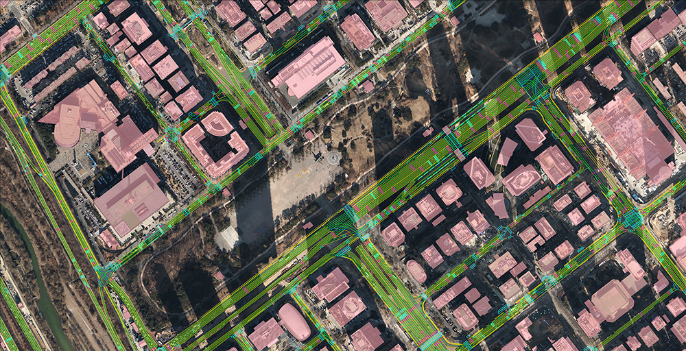
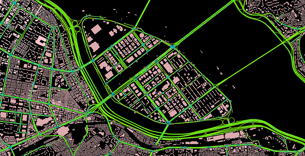
Creating this precise road layout in the megacity of Seoul is particularly meaningful. This is an essential technology for the informatization of roads and cities in the future. Not only is it important to accelerate autonomous driving, but it can also be used in various ways to provide safe and convenient on-road information and services.
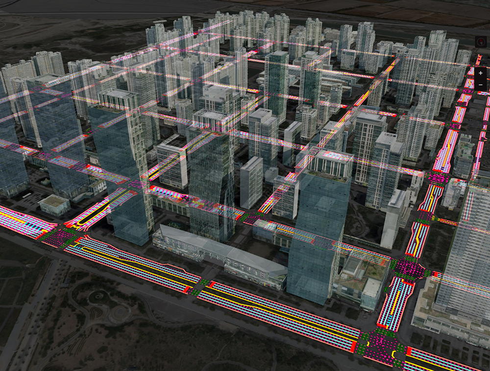
Enhanced accuracy with deep learning and vision
NAVER LABS completed the first version of its road layout across Seoul at the end of last year, and this newly unveiled version has improved accuracy with less than 16 cm margin of error. Various deep learning and vision technologies have been applied to extract road data and improve accuracy.
To begin with, we need technology that removes unnecessary obstacles on the road, such as cars and trees, to generate and merge true orthophotos. Then, we apply a height refining algorithm to obtain more accurate road data and finally complete the road layout map with 3D expansion technology.
We separately developed and applied an AI-based automatic algorithm to extract lanes and road surface markings, which allowed us to improve accuracy while reducing time and cost.
Related article: Extracting road layout information from aerial images through deep learning technology
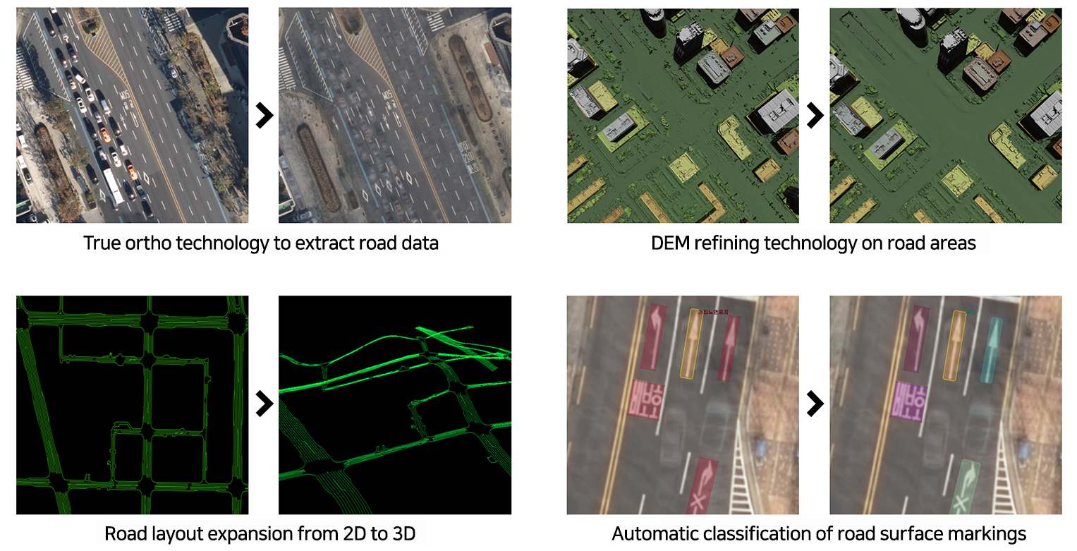
1) True ortho technology to extract road data: Generates true orthophotos that can identify covered road surface signs
2) DEM refining on road areas: Removes unnecessary on-road obstacles, such as cars and trees, and levels out height
3) Road layout expansion from 2D to 3D: Enters road height data into 2D road layout data to convert into 3D
4) Automatic classification of road surface markings: Uses deep learning algorithm to automatically classify road surface markings, indicated as boxes
Hybrid HD mapping and three outputs
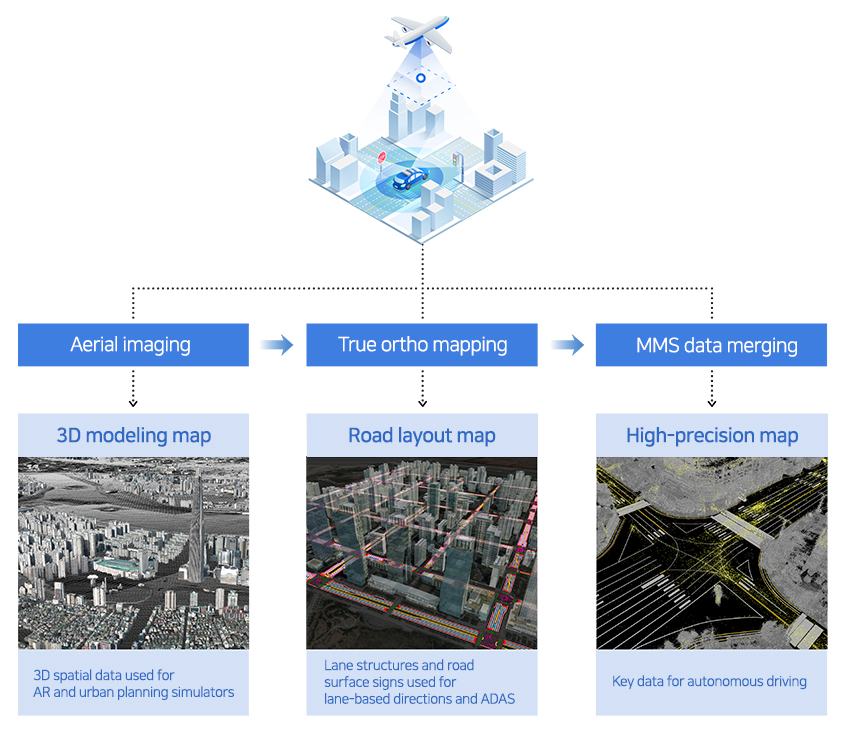
NAVER LABS has its original HD mapping technology—hybrid HD mapping, which merges aerial images and MMS data. With this technology, we can produce three outputs: 3D modeling extracted from aerial images, road layout extracted from lanes and road surface markings, and HD map merged with MMS data. Each data output can be used for various purposes, such as digital twin, precise directions and autonomous driving.
3D modeling of Seoul, which we unveiled earlier, has been applied to the Virtual Seoul platform and is used to review urban planning, simulate urban windways, and manage IoT sensor-based firefighting facilities. Furthermore, the road layout can be used for lane-level navigation or AR HUD and ADAS.
Related article: AHEAD (3D AR HUD) demonstration in a real urban environment
Following last year, NAVER LABS distributed some HD map dataset for free this year as well, which was developed using this road layout. Furthermore, NAVER LABS has recently signed an MOU with the city of Seongnam to develop AI and autonomous driving industries, and is planning to use three data outputs based on hybrid HD mapping to continue collaboration in developing fully urban autonomous driving technologies and expanding research communities.